Option C – via Rocester
Text from Uttoxeter Canal Restoration Outline Feasibility Study
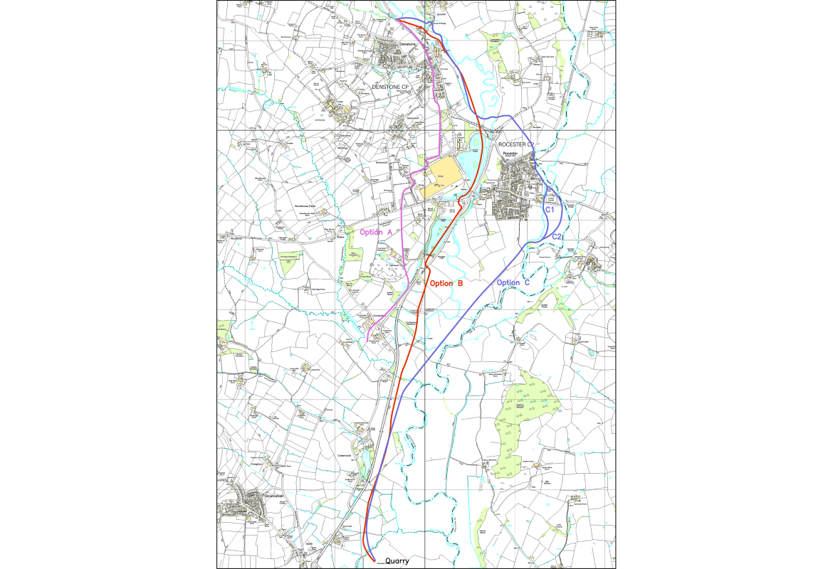
For the first 1.5 km, as far as the B5031, this would follow the same route as Option B. The canal would diverge from route Option B at the B5031, at which point it would head east. The canal would then need to cross the River Churnet. While it would be preferable to continue [at the same level] this would require the construction of an embankment in the flood plain of the River Churnet, which is unlikely to be acceptable. It may therefore be necessary to lock down before locking back up. A new culvert crossing below the B5030 would then be required, though no road raising would be necessary.
Between the B5030 and Rocester, the canal would cross an area of high ground. It may not be possible to skirt around this area due to the presence of remains of a Roman fort near Ashbourne Road. A cutting up to 6 or 7 metres deep may therefore be required. In order to pass Rocester, the canal would need to either run alongside or through the River Dove. To the north of Mill Street is an existing football ground. A lock would be required to the north of this ground. The canal could then pass to either side of this ground, Option C1 would pass the new JCB academy development but would require major works to lift Mill Road to allow the canal to pass. Option C2 would not require any road raising, but a new culvert would be required under the existing road.
From here the canal would head south-west through the flat floodplain area between the River Dove and the River Churnet via two further locks. A crossing structure would be required at the River Churnet and the canal would continue south-east to meet with the route described above under Option B.